Monitoring Water Quality and Quantity with Earth Observation Techniques
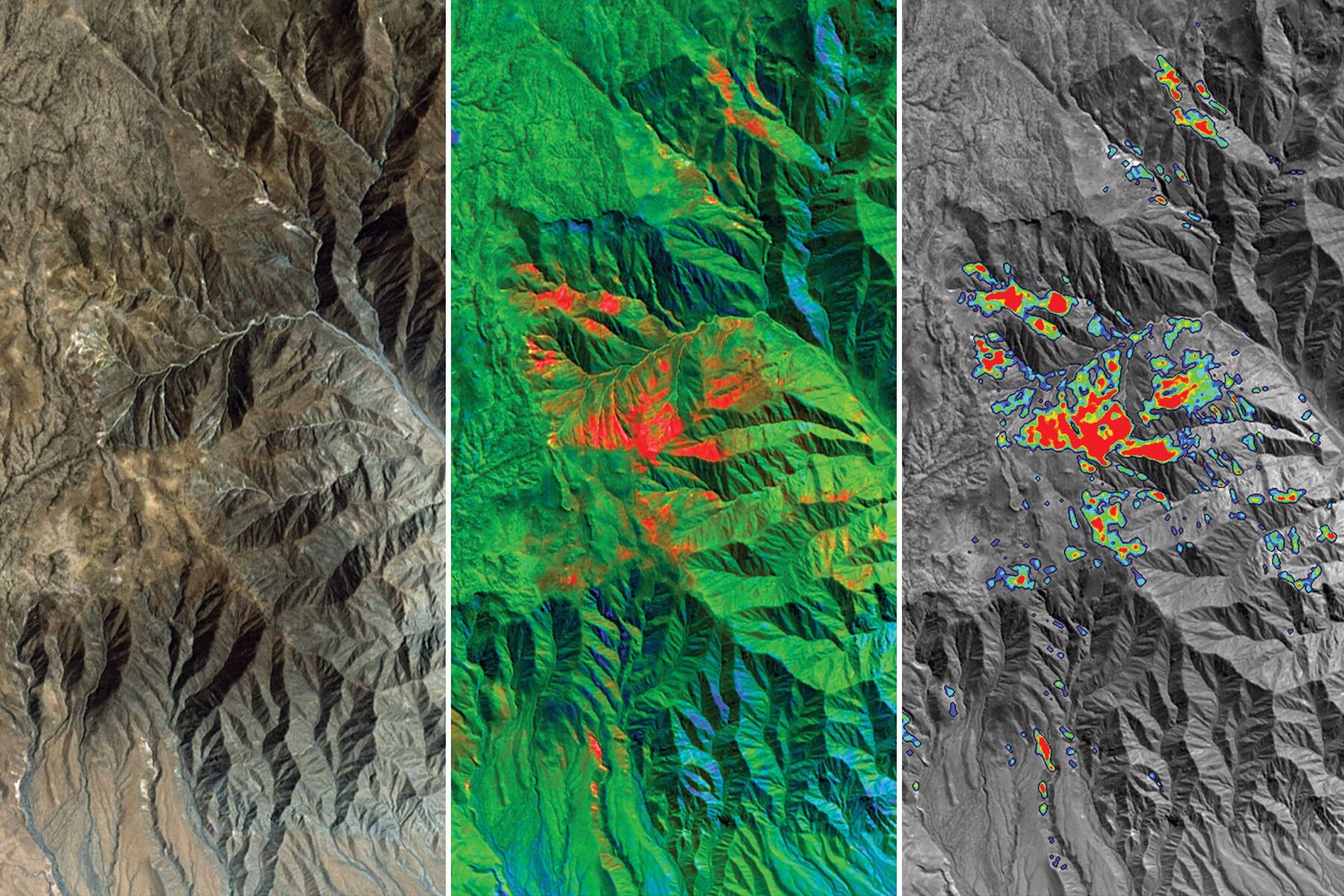
Water quality monitoring is fundamental to sustainable water management. It provides essential data and information, which characterize the physical, chemical and/or biological state of water resources. Water quality data and information are crucial for the assessment of water quality trends and changes in the world’s freshwater resources and the identification of emerging water quality issues. Water quality monitoring are capacities are limited, particularly in developing countries due to the lack of monitoring networks, technical human and financial resources, and scientific knowledge. It is furthermore becoming more complex and resource-demanding to monitor diverse new pollutants, such as emerging pollutants, that are found in wastewater and freshwater systems. Advanced water quality monitoring techniques and innovative technologies, such as remote sensing, satellite Earth Observation and smart sensors, will help produce reliable, continuous, and systematic data on the quality of water resources across extensive spatial and temporal scales.1
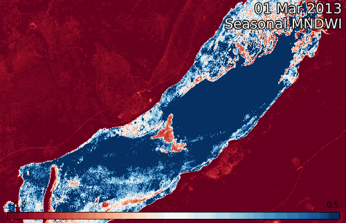
Recent studies have shown that globally, riverine, and coastal floods are increasing in intensity and duration. In addition, the number of people living in flood-prone areas has increased substantially during the last two decades. Therefore, monitoring and predicting floods in support of early warning, response, and relief operations have become key focal points for disaster management activities worldwide. Remote sensing observations from optical and Synthetic Aperture Radar (SAR) sensors are routinely used for detecting and mapping flooding. Moreover, empirical methodologies developed using remote sensing observations of rainfall, terrain, soil moisture, and landcover, as well as weather modeling data have been used for flood monitoring. Sophisticated and complex land hydrology and runoff routing models are also being used for mapping and predicting riverine and urban flooding.2
1) https://en.unesco.org/waterquality-IIWQ/activities-projects/monitoring-water-quality-wastewater
2) https://appliedsciences.nasa.gov/join-mission/training/english/arset-monitoring-and-modeling-floods-using-earth-observations