Mining
Numerous industries worldwide depend on minerals that are mined from the ground. The revenue from mining is over a trillion USD annually.1 Satellite data can help support more efficient and environmentally friendly mining and resource extraction around the world. Remote sensing images can be used for mineral exploration in two general categories, 1) to map geology and the faults and fractures that localize ore deposits; 2) recognize hydrothermally altered rocks by their spectral signatures.2 Landsat and Sentinel data has historically supported mining assessments, but new higher spectral and spatial resolution sensors are bringing even more valuable insights to the industry
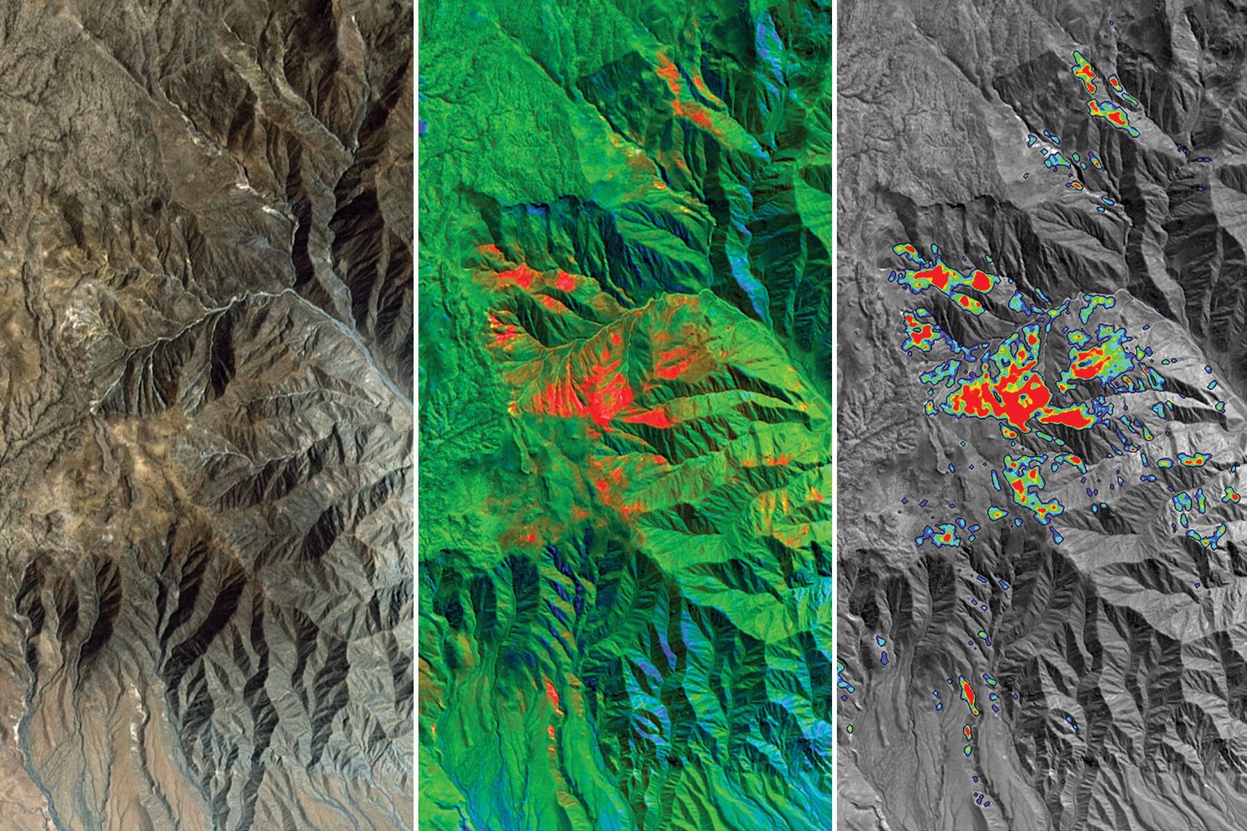
Using remote sensing data and image analysis tools to identify mineral deposits
In addition to supporting the discovery and extraction of new mineral deposits, remote sensing technology can also allow for more effective monitoring and detection of illegal and un-regulated mining that takes place around the world today. Unregulated mining practices have a detrimental impact to public health due to higher levels of pollution and poor working conditions. A World Economic Forum report on the state of mining in Africa estimates that unregulated gold mines cause $9 billion in economic damage a year. It goes on to explore how satellite data that can help in prevent 10% of unregulated mining would be worth $900 million to the African economy.3 Analysts can use satellite data to compare and observe changes in land use and surface activities to identify mining activity such as the creation of artificial ponds or land being cleared for access road.
1) https://www.statista.com/topics/1143/mining/#topicHeader__wrapper
2) https://www.sciencedirect.com/science/article/abs/pii/S0169136899000074
3) https://www.weforum.org/reports/unlocking-the-potential-of-earth-observation-to-address-africa-s-critical-challenges