Monitoring Climate change
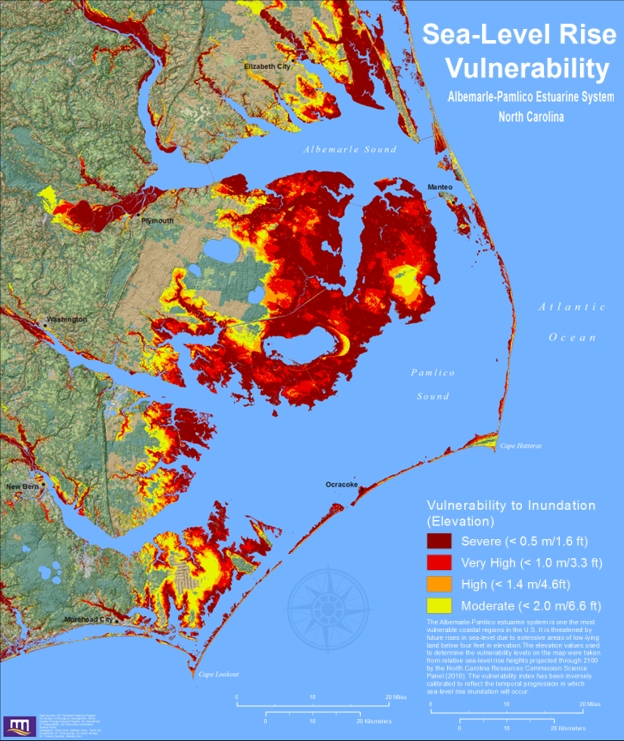
Advances in the scale and accessibility of satellite data as well as increased temporal resolution have unlocked new potentials in monitoring, adapting, and mitigating against a changing climate around the world. Remote sensing can be used for improving understanding of climate systems and their changes. It enables us to monitor the Earth surface, ocean and the atmosphere at several spatio-temporal scales, thus allowing climate system observations, as well as to investigate climate-related processes or long and short-term phenomena, as for example deforestation or El Niño trends. Moreover, remote sensing is useful to collect information and data in dangerous (e.g., during fire events) or inaccessible areas (e.g. remote regions). Specific examples of remote sensing uses also related to climate change adaptation practices include: natural resource management, management of agricultural practices, for example related to land use, land conservation and soil carbon stock, tactical forest fire-fighting operations in real-time decision support systems, monitoring of land cover and its changes over different temporal and spatial scales, even after a disaster event, better informed forest and water management, evaluation of carbon stocks and related dynamics, simulation of climate system dynamic, improvement of climate projections and meteorological reanalysis products, widely used for climate change research studies.1
