Satellite Coverage
A variety of factors impact the coverage of a given satellite/constellation. The most important factors dictating whether an image is collected and/or useful is the orbit of the satellite, the cloud cover over the desired AOI, and whether the sensor was actively collecting data.
As stated previously the swath of a specific sensor dictates how much imagery can be captured in a single collect. Satellites with moderate-low resolution sensors will have a much larger swath than a high-resolution sensor like what is onboard WorldView-3. Commercial satellites often have a dynamic ability to increase the ‘length’ of a collection to cover more area, whereas federally managed assets like Sentinel and Landsat have standard collection sizes. Most moderate-low resolution sensors are launched in an orbit and with a collection plan that is designed to cover the globe in a regular cadence. Commercial companies launch constellations of satellites, much like Planet’s ‘Dove’ constellation, to achieve global coverage while still being able to maintain moderate-high resolution. Commercial providers will design orbital plans for individual satellites so they can cover the globe with a generally high cadence, but it is important to note that just because a commercial sensor is passing over a region of Earth does not mean it is actively capturing imagery. This is due to many factors including available storage on the sensor, cloud cover, and commercial interest over a given area.
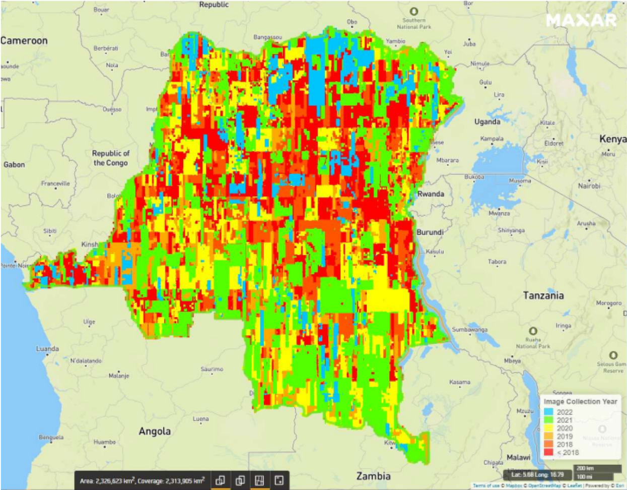
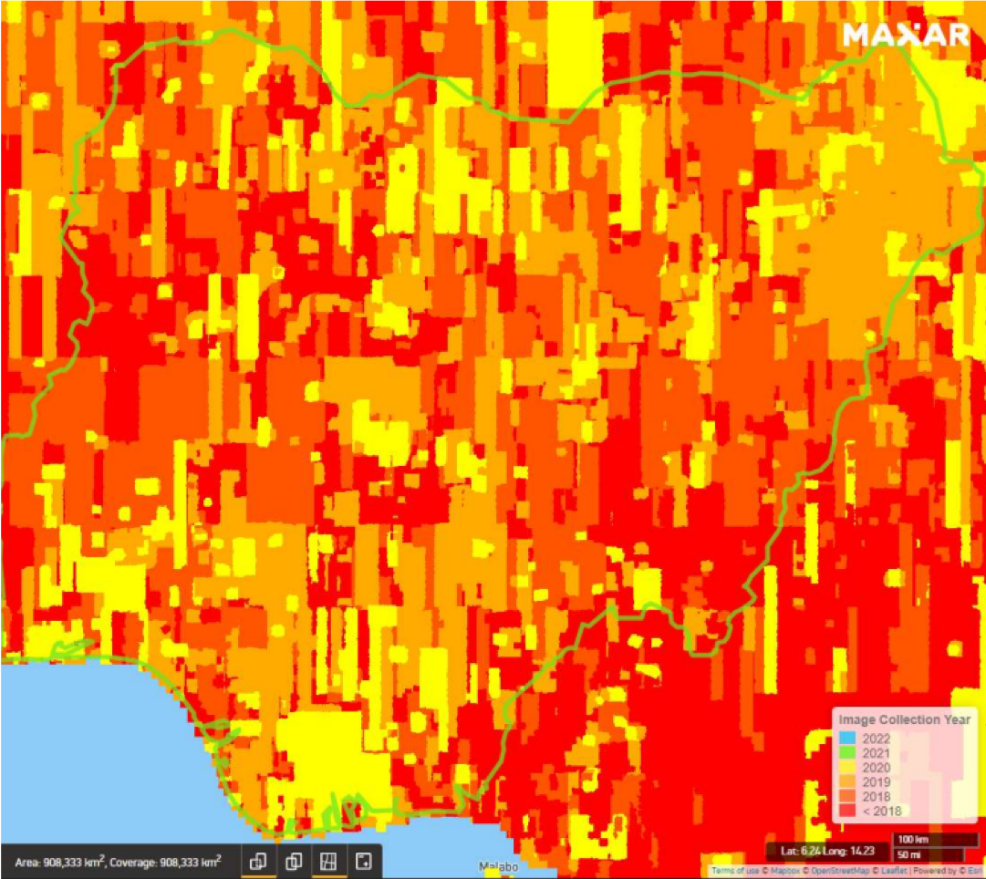
Sensors like Landsat and Sentinel are always “turned on” and downlinking the data they collect, even over areas with dense cloud cover with no usable image collected of the Earth’s surface. Cloud cover is the enemy of optical imaging satellites, and results in fewer usable images being available, particularly over equatorial and tropical regions. Commercial companies will plan their collection plans based on both historical and real-time weather data, looking to capture as many usable images as possible. While cloud cover will remain a persistent issue for optical sensors into the foreseeable future, it is still possible to ‘task’ a commercial satellite to collect imagery over an area that is expected to be cloudy, especially while a major weather event is unfolding, in the hopes that you can get lucky and pull down a usable image. Persistent cloud cover typically results in a lower number of archival images found over regions like the Amazon, the Democratic Republic of Congo, and some of Southeast Asia.
Beyond these weather-based and hardware/design-based issues, there is also the concept of commercial interest in a particular region. Many commercial providers sell their data to governments and major technology companies to update their maps and track change on the surface of the Earth, among other factors, and oftentimes this results in less ‘interest’ over much of the Global South. While the Global South is of course incredibly dynamic and ever-changing, the commercial interest in an image captured over rural South Sudan is less than that of Manhattan, Paris, Tokyo, etc. This typically results in there being fewer total images in an archive over Sub-Saharan Africa than ‘high-interest’ regions like Western Europe. While this may mean that there is less of a focus for commercial providers to collect imagery over rural portions of the Global South, it also means that these high-resolution sensors have more ‘capacity’ when orbiting above some of these regions. Capacity essentially means the ability for a sensor to collect imagery over an area. Increased capacity allows for better results with tasking, and many users of satellite data in global development have an increased ability to task a satellite over an AOI in the Global South due to the satellite (or satellites) having open capacity.
The factors mentioned above dictate the available and usable archive for any given sensor. One of the many reasons users focus on assets like Landsat and Sentinel is due to their guaranteed revisit schedule. While there may be issues of clouds at given times, you can still expect an image to be captured over a given area on a specific date. The confidence in availability of images coming from high-resolution sensors varies, with certain constellations specifically designed to revisit areas, while others weigh the factors above prior to deciding whether they collect data over an area or not.
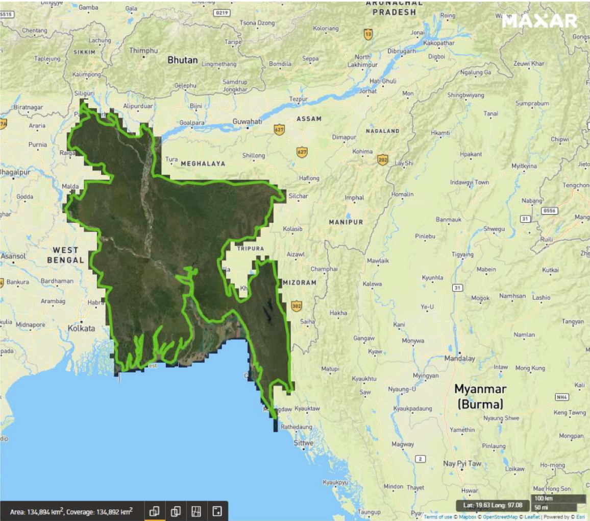
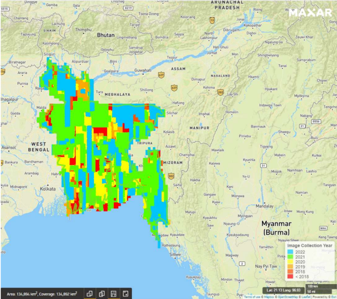
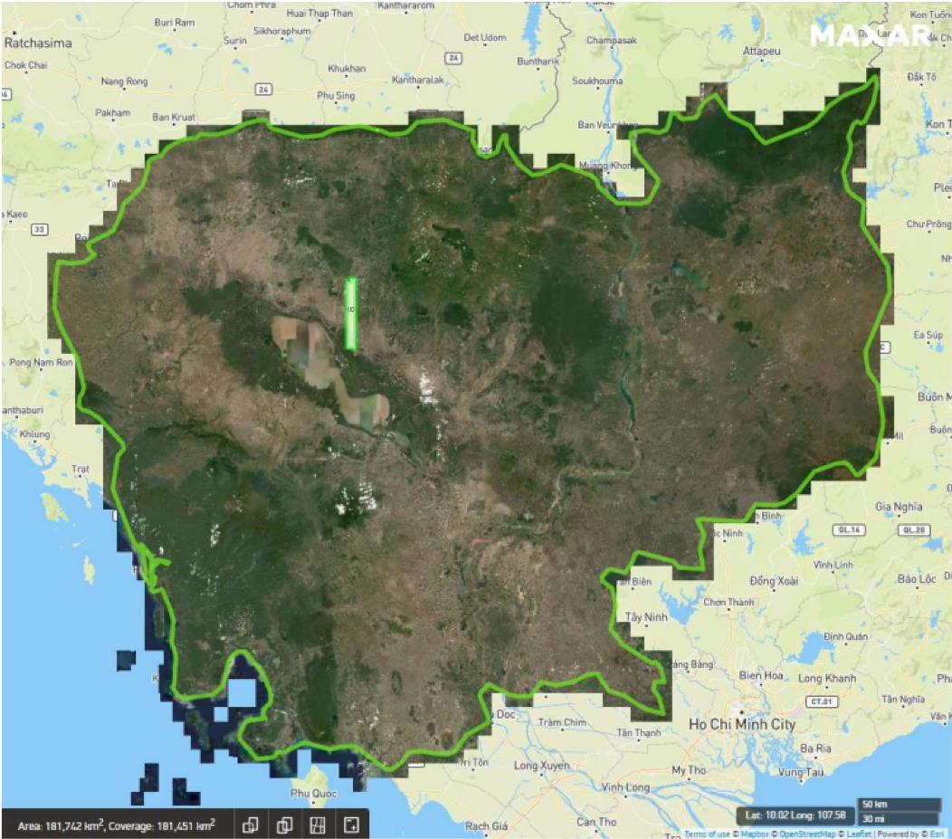
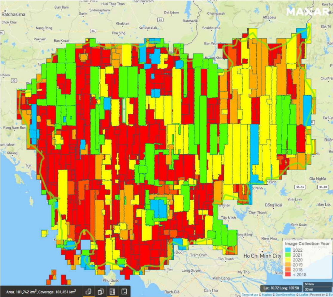
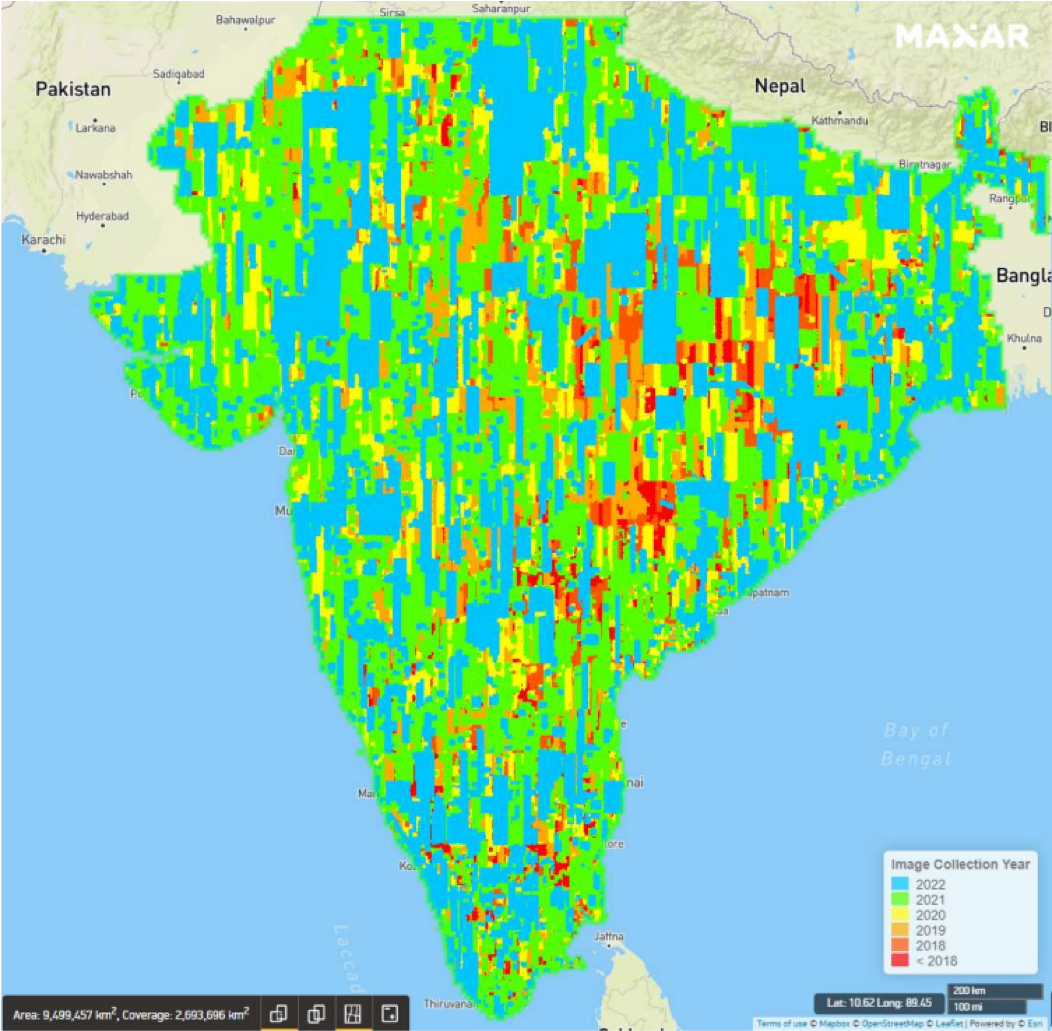
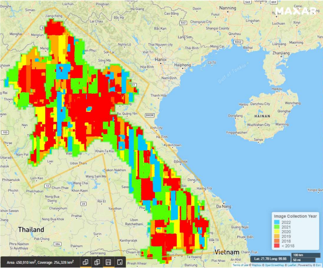
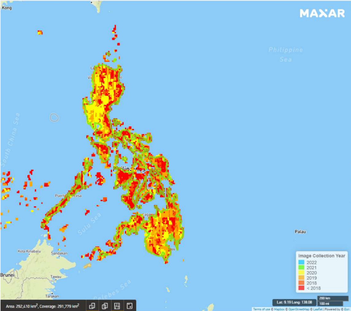
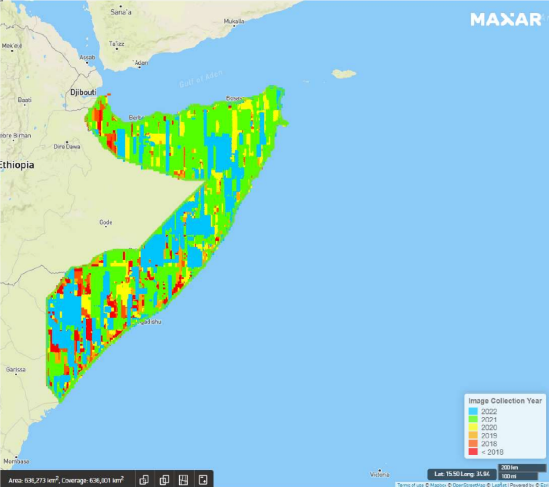
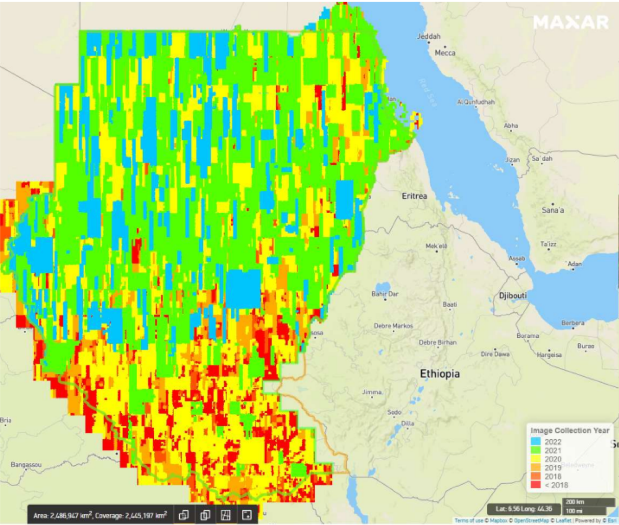
The images below detail the currency of images used in Maxar mosaics as of September, 2022, with the legend showing the image age by color. Covered in more detail in the ‘Distribution’ section, a mosaic is a patchwork of (mostly) cloud free images. The date ranges shown in the images somewhat highlight this reduced focus of collection over these areas, though it is strongly encouraged to reach out to the provider in question to get the most accurate sense of data availability over an AOI.
Image Collection Year
- 2022
- 2021
- 2020
- 2019
- 2018
- <2018